Planning Your Island‑Wide Sri Lanka Road Trip
An island‑wide road trip in Sri Lanka is absolutely doable for locals with their own car or bike, as long as you plan around fuel costs, expressway tolls, and safe, practical routes. This section breaks down how to design a realistic loop that covers most provinces without exhausting your budget or your passengers.
1. Decide Your Direction and Rough Loop
For most Sri Lankans starting from the Western Province, the classic loop is:
- Colombo / Gampaha → Anuradhapura → Jaffna (north)
- Jaffna → Trincomalee / Nilaveli → Batticaloa / Passikudah (northeast / east)
- Batticaloa → Arugam Bay → Ella / Badulla / Haputale → Nuwara Eliya / Kandy (east to highlands)
- Kandy → Matale → Dambulla / Sigiriya → Kurunegala (cultural triangle loop)
- Kurunegala → Kegalle → Ratnapura → Kataragama / Yala → Hambantota (south‑central)
- Hambantota → Tangalle → Matara → Mirissa / Weligama → Galle → Colombo (southern coast and back)
You can reverse the direction or skip segments, but keeping a loop avoids backtracking and saves both time and fuel.
2. Budgeting Your Fuel Costs
Fuel will be your single biggest running expense, so estimate it before you confirm dates and hotels.
2.1 Estimate Total Distance
An island‑wide loop that touches the north, east, highlands, and south typically falls in the 1,400–1,800 km range depending on detours. As a rough guide:
- Western Province to Jaffna via A9: ~400 km (one way)
- Jaffna to Trincomalee: ~260–300 km
- Trincomalee to Batticaloa / Passikudah: ~110–140 km
- Batticaloa to Arugam Bay: ~140–170 km
- Arugam Bay to Ella: ~190–220 km (via Monaragala / Wellawaya)
- Ella to Nuwara Eliya / Kandy / Dambulla loop: ~350–450 km with sightseeing
- Dambulla to Kataragama / Yala via Kurunegala–Kegalle–Ratnapura: ~350–450 km
- Yala / Hambantota to Colombo along the south coast: ~270–300 km
Add an extra 15–20% for local driving (beach runs, temple visits, food runs).
2.2 Calculate Fuel Usage
Use your own vehicle’s realistic consumption, not the showroom figure. As a basic template:
- Small car / hybrid: 12–18 km per litre
- Mid‑size petrol car / automatic: 9–13 km per litre
- SUV / van: 7–11 km per litre
- 125–150cc bike: 30–45 km per litre
Step‑by‑step:
- Decide your planned distance (e.g., 1,600 km).
- Divide by your average km/L (e.g., 1,600 ÷ 12 = 133 L).
- Multiply by the current pump price (petrol or diesel).
Do this with a slight buffer (round up your litres by at least 10%) to account for city traffic, AC use, and idling.
2.3 Ways to Reduce Fuel Spend
- Drive at a steady, moderate speed (80–90 km/h on expressways, 50–60 km/h on A‑roads where safe).
- Avoid excessive idling in temple car parks or view points; switch off if you will wait more than a couple of minutes.
- Keep tyres correctly inflated and don’t overload the vehicle with unnecessary luggage.
- Use AC sensibly in the highlands where you can drive with windows partially open instead.
3. Expressway Tolls and When to Use Them
Expressways save time and stress, especially at the beginning and end of your trip, but they add toll costs. Plan where using them genuinely makes sense.
3.1 Key Expressway Segments for an Island‑Wide Loop
- E01 Southern Expressway: Kottawa–Galle–Matara–Hambantota
Use when:- You are connecting Colombo–Galle–Matara–Hambantota quickly, especially at the end of the trip when everyone is tired.
- You want to avoid congested A2 coastal road through Kalutara, Aluthgama, and Galle town.
- E02 Outer Circular Expressway: Kerawalapitiya–Kadawatha–Kottawa
Use when:- You are connecting from Katunayake / Negombo / A1 to the Southern Expressway without entering central Colombo.
For the rest of the loop (A9 to Jaffna, A6/A11/A15 on the east coast, A4/A5/A16 in the highlands), you will use the free national highways.
3.2 Estimating Toll Costs
Toll charges depend on vehicle category and distance. For planning:
- Check the current toll rate per segment for your vehicle type (car, van, bus) before departure.
- Estimate at least a few thousand rupees for a full south‑coast run via the E01 from Colombo to Hambantota and back, especially if you also use the Outer Circular Expressway.
- Keep small notes or use card / digital payment where available to avoid delays at toll booths.
Build tolls into your total transport budget rather than treating them as incidental, especially if you plan multiple expressway legs.
4. Safe and Practical Route Choices
Safety on an island‑wide trip is mostly about road condition, traffic habits, weather, and time of day. The goal is not only to avoid danger but also to reduce fatigue.
4.1 Safer Main Corridors
When in doubt, stick to A‑class highways and expressways:
- A1 / A3: Colombo–Kandy / Negombo corridors
- A9: Kurunegala–Dambulla–Vavuniya–Jaffna (main north–south spine)
- A6 / A11 / A15: Dambulla–Habarana–Trincomalee–Kalkudah–Batticaloa–Trinco / Jaffna links
- A4: Colombo–Ratnapura–Balangoda–Beragala–Bibile–Pottuvil / Arugam Bay
- A5 / A16: Peradeniya–Nuwara Eliya–Badulla–Passara / Maha Oya
- A2: Colombo–Galle–Matara–Hambantota (if not using E01)
Use B‑roads and estate roads only for short, planned scenic detours (e.g., to waterfalls or viewpoints) and avoid relying on them as your primary long‑distance routes, especially at night.
4.2 Time‑of‑Day Safety
- Avoid long night drives between towns, especially in:
- Dry zone wildlife areas (Elephant / deer crossing risk).
- Hill country with fog, rain, and sharp hairpins.
- Try to finish your major intercity drives by 6–7 PM at the latest, and only drive short familiar stretches after dark.
- Plan early morning starts (5–6 AM) for long legs like Jaffna–Trincomalee or Arugam Bay–Ella.
4.3 Weather and Seasonal Risks
Sri Lanka’s monsoon patterns mean some roads are more prone to landslides, floods, or poor visibility at certain times of the year:
- Hill country (Nuwara Eliya, Haputale, Badulla) can face landslides and dense fog in heavy‑rain periods.
- Low‑lying east and north‑central areas may flood during heavy rain; check local advisories before using alternative shortcuts.
- Avoid hill‑country night drives in the rain if you are not very experienced with mountain roads.
Always check local police or disaster management updates if you hear of landslide warnings, especially before using A4, A5, A16, and smaller mountain roads.
5. Sample Island‑Wide Itinerary Structure
This is a planning template for Sri Lankans with their own vehicle wanting to circle the island in about 14–18 days. Adjust nights per place to your interests.
- Leg 1: Western Province → North
Route: Colombo / Gampaha → Kurunegala → Dambulla → Anuradhapura → Jaffna (A1/A9)
Focus: Sacred cities, reservoirs, Jaffna Peninsula, Point Pedro. - Leg 2: Jaffna → Northeast Coast
Route: Jaffna → Kilinochchi → Vavuniya → Trincomalee / Nilaveli (A9/A12/A6 or A9/A15)
Focus: Koneswaram, Nilaveli / Uppuveli beaches, snorkelling and marine life. - Leg 3: Trincomalee → East Coast
Route: Trincomalee → Kinniya → Kantale → Kalkudah / Passikudah → Batticaloa (A15)
Focus: Calm beaches, lagoon food, relaxed coastal towns. - Leg 4: Batticaloa → Southeast Surf Belt
Route: Batticaloa → Kalmunai → Pottuvil → Arugam Bay (A4 / local coastal roads)
Focus: Surfing, chill beach time, lagoons. - Leg 5: Arugam Bay → Hill Country
Route: Arugam Bay → Monaragala → Wellawaya → Ella / Haputale → Nuwara Eliya / Kandy (A4/A23/A16/A5)
Focus: Waterfalls, tea estates, viewpoints, train experiences if you combine with a train leg. - Leg 6: Cultural Triangle Loop
Route: Kandy → Matale → Dambulla → Sigiriya → Habarana → Anuradhapura / Polonnaruwa → back to Kandy or Kurunegala
Focus: Ancient cities, Sigiriya / Pidurangala, Dambulla cave temple, national parks. - Leg 7: South‑Central and Yala
Route: Kandy / Kurunegala → Kegalle → Ratnapura → Embilipitiya → Tissamaharama / Kataragama (A4/A18 and connector roads)
Focus: Temples, gems, Udawalawe / Yala safaris. - Leg 8: Southern Coast → Back to West
Route: Tissamaharama → Hambantota → Tangalle → Matara → Mirissa / Weligama → Galle → Colombo (A2 or E01)
Focus: Beaches, whale watching, Galle Fort, seafood, quick return on expressway at the end.
You can compress this by merging cultural triangle stops, skipping Jaffna or Arugam Bay, or trimming nights in the hill country depending on leave and budget.
6. Daily Driving Limits and Rest
A safe and sustainable island‑wide trip balances sightseeing with reasonable drive times:
- Aim for 3–6 hours of driving per day on long legs.
- Every 2–3 hours, plan for at least a 15–20‑minute break (tea, washroom, fuel).
- Rotate drivers if possible; if only one driver, schedule rest days where you park the vehicle and explore locally on foot or by tuk‑tuk.
7. Fuel, Safety, and Practical Tips for Sri Lankans
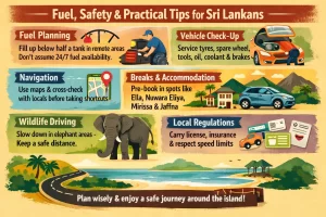
- Fuel planning: In remote areas (between major towns in the north and east, or deep rural routes), fill up whenever you fall below half a tank. Do not assume 24/7 fuel availability in smaller towns.
- Vehicle check‑up: Before departure, get a full service including tyres, spare wheel, tool kit, jack, coolant, brake fluid, engine oil, and wiper blades. Mountain and coastal humidity can be hard on older vehicles.
- Navigation: Use digital maps but cross‑check with locals before taking unfamiliar shortcuts across forests or estates.
- Breaks & accommodation: Pre‑book at least in popular areas like Ella, Nuwara Eliya, Arugam Bay (in season), Mirissa, and Jaffna to avoid last‑minute long drives searching for rooms.
- Wildlife driving: In known elephant corridors (e.g., between Habarana and Trincomalee, some parts of the southeast), slow down, avoid honking aggressively, and never stop dangerously close to wild elephants for photos.
- Local regulations: Carry original or legally acceptable copies of driving licence, registration, insurance, and emission certificate. Respect speed limits, especially on A‑roads passing through towns and villages.
With realistic fuel and toll budgeting, careful route choices along the main national highways, and sensible driving hours, Sri Lankans can comfortably complete an island‑wide loop that is both safe and deeply rewarding.
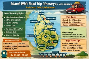
Fuel Costs and Budgeting for an Island Loop
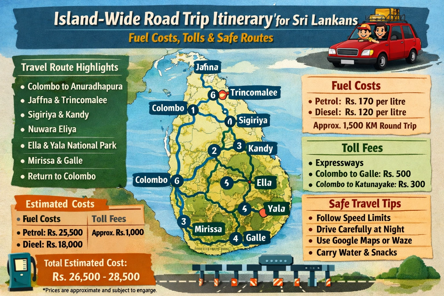
For a full island loop by road, fuel will be one of your biggest variable expenses, so it is worth estimating carefully before you set off. A typical island‑wide circuit (Colombo – cultural triangle – hill country – East Coast – South Coast – back to Colombo) is usually around 1,000–1,500 km, depending on detours and side trips.
1. Estimating Total Fuel Consumption
Start by estimating your total distance and your vehicle’s average fuel consumption:
- Typical loop distance: 1,000–1,500 km for a full circuit with a few detours.
- Small car / hybrid: roughly 6–7 L per 100 km on mixed Sri Lankan roads.
- Compact SUV: roughly 7–9 L per 100 km.
- Motorbike / scooter: 2.5–4 L per 100 km.
- Tuk‑tuk (three‑wheeler): about 4–5 L per 100 km.
As a quick rule of thumb, a 1,200 km loop in a standard car at 7 L/100 km will use about 84 L of fuel; a tuk‑tuk or motorbike will use roughly half or less for the same distance.
2. Current Fuel Prices and Effects on Your Budget
Fuel prices in Sri Lanka fluctuate, but petrol and diesel are usually among the cheaper components of a private road trip compared with accommodation and food. For planning purposes:
- Assume a mid‑range price per litre for petrol (95) or diesel when doing your math.
- Remember that higher prices in 2022–2023 during the fuel crisis have largely stabilised, but small changes still impact taxi and tuk‑tuk fares.
- Motorbike and tuk‑tuk travellers typically report that fuel forms a small share of total trip costs because of very low consumption.
A practical way to stay on top of your budget is to recalculate your per‑day fuel spend every few days rather than for the entire loop at once. This lets you react if prices change or if you end up driving more than planned.
3. Daily Fuel Budget by Vehicle Type
For an island‑wide loop of 10–14 days, you can use these rough planning figures for fuel only (not including rental or driver fees):
- Private car (self‑drive or with driver): Budget for a moderate daily distance (80–150 km/day). Over a typical loop, fuel might average the equivalent of a modest daily spend that is usually less than what you’ll spend on food.
- Tuk‑tuk (self‑drive): Many travellers driving around 1,000 km report fuel making up a small fraction of total transport costs, thanks to low consumption and relatively low per‑litre prices.
- Motorbike / scooter: Fuel is usually negligible day‑to‑day; your main cost is the rental itself.
Sri Lankans using their own vehicles will see especially low marginal costs: your main expense is the fuel itself, plus any tolls and routine maintenance.
4. Tolls and Expressway vs. Local Roads
Expressways (E01, E02, E03, etc.) charge tolls but can save significant time and fuel on long stretches:
- Where tolls apply: Primarily on expressways linking Colombo with the South, Katunayake airport, and some inland sections.
- Benefits: Higher, more consistent speeds; fewer stops; less idling in traffic; safer conditions than some local highways.
- Trade‑off: You pay tolls but often save fuel and time compared with congested coastal or A‑class roads.
For detailed toll and fuel combinations on different route options, tools like Sri Lanka‑specific toll calculators and road‑trip fuel apps can help you compare:
- Enter your vehicle type, fuel consumption, and start/end points.
- Get an estimated breakdown of toll charges plus fuel consumed on each route (fastest vs. cheapest).
- Use this to decide, for example, whether to use the expressway between Colombo and Galle or take the slower coastal road.
5. Fuel Planning for Safe and Smooth Travel
Even though fuel shortages have eased, basic planning reduces stress:
- Keep a buffer: Refill when your tank reaches 1/3–1/2 on long rural stretches (e.g., between the cultural triangle and the East Coast, or in the far North).
- Use major towns: Plan main fills in larger centres (Colombo, Kandy, Galle, Matara, Kurunegala, Anuradhapura, Trincomalee, Batticaloa, Jaffna), where fuel availability and card payments are more reliable.
- Cash vs. card: Keep some cash on hand; not all smaller stations accept cards consistently.
- Peak‑time queues: In busy urban areas, avoid refuelling at rush hour to minimise time lost in lines.
For Sri Lankans using their own vehicles, monitoring official Ceylon Petroleum Corporation channels or local news before departure can clarify any temporary regional shortages or price changes.
6. Building a Realistic Transport Budget
To build a practical island‑loop budget, combine four components:
- Fuel: Estimate total litres (based on distance and consumption) multiplied by a conservative per‑litre price.
- Tolls: Add estimated expressway tolls by section; include a small buffer for using expressways more than planned.
- Parking / miscellaneous: Include an allowance for paid parking in cities, vehicle washing, and small roadside fees.
- Alternative transport: Even with your own vehicle, set aside a small daily amount if you plan to park and use local tuk‑tuks in congested areas or at night for safety.
A useful method is to set a per‑day transport envelope (fuel + tolls + parking + occasional tuk‑tuks). Track actual spending briefly each evening; if you underspend in one region, you can afford more detours or expressway use later in the loop.
7. Cost‑Saving Tips for Sri Lankans on an Island Loop
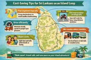
- Plan segments logically: Group destinations to avoid needless backtracking; this reduces both fuel and tolls.
- Use expressways strategically: Reserve toll roads for long, congested stretches (e.g., entering or leaving Colombo, Colombo–Galle, Matara–Hambantota) and enjoy slower scenic roads where traffic is lighter.
- Drive efficiently: Maintain moderate speeds, avoid harsh acceleration and heavy braking, and keep tyres properly inflated to reduce consumption.
- Share costs: If travelling with friends or family, split fuel and tolls; apps that calculate trip fuel costs and allow cost splitting make this easier.
- Mix modes where sensible: For very crowded heritage towns or hill stations, consider parking outside and using local buses or tuk‑tuks for short internal hops.
With realistic assumptions about distance, consumption, and toll use, most Sri Lankan travellers can keep fuel and tolls as a manageable share of their total island‑loop budget while still prioritising safe, comfortable routes.
Expressways, Tolls, and Typical Charges
Sri Lanka’s island‑wide road trips increasingly combine scenic A‑ and B‑roads with high‑speed expressways, which are all access‑controlled, tolled highways designed for faster and safer long‑distance travel. For Sri Lankans planning a circuit around the island, understanding which expressways to use, how tolls are calculated, and what you typically pay by vehicle type is essential for budgeting and route planning.
Key Expressways for an Island‑Wide Loop
Most practical island‑wide itineraries for Sri Lankans will touch several of the following E‑grade highways at different stages of the trip:
- E01 – Southern Expressway
Connects the Colombo outer suburbs (Kottawa) with the deep south via Galle, Matara, and further to Hambantota/Mattala. This is the main high‑speed backbone for western–southern–southeastern legs. - E02 – Outer Circular Expressway (OCH)
Arcs around Colombo between Kerawalapitiya and Kottawa, allowing you to bypass inner‑city congestion when moving between northern, eastern, and southern segments of the island‑wide route. - E03 – Colombo–Katunayake Expressway (CKE)
Links Colombo’s northern edge with Bandaranaike International Airport and the Negombo area. Useful for starting/ending the loop near the airport or for quickly connecting the coastal northwest to the OCH. - E04 – Central Expressway
Currently open from Mirigama to Kurunegala, with further stages towards Kandy and Dambulla progressing. On an island‑wide itinerary, this reduces travel time between the western province and the north‑central/cultural triangle once more stages open. - E06 – Magampura Expressway
Connects the Southern Expressway near Andarawewa to the Hambantota port area, useful when your route extends into the deep southeast and Hambantota region.
All of these expressways are toll roads with speed limits generally between 80–110 km/h and restrictions on slow vehicles (no bicycles, three‑wheelers, tractors, or motorcycles), making them safer and faster for cars, vans, and buses compared to most A/B‑class highways.
Current Toll Policy and Payment Methods
As of late 2025, the temporary toll waivers introduced during adverse weather and economic disruptions have been lifted, and standard tolls are now charged on all expressways. Expect to pay at every entry/exit, unless there is a clearly announced special waiver (which is usually time‑bound and widely publicised).
Tolls are collected by the Road Development Authority (RDA) using:
- Manual cash booths at all expressway interchanges, which remain the default for most routes and vehicle classes.
- Electronic Toll Collection (ETC / e‑toll):
- Fully functional on the Colombo–Katunayake Expressway (E03) for compatible tags.
- Being expanded on the Southern Expressway (E01) in stages, especially at busier interchanges.
- On the Outer Circular Expressway (E02), e‑toll tags may still require you to pass through designated cash lanes or mixed‑mode lanes depending on the latest RDA configuration.
At complex interchanges like Kerawalapitiya (where E02 and E03 meet), the RDA has revised ticket issuing to simplify traffic. In practice this means:
- When entering the CKE via Seeduwa or Peliyagoda, your entry ticket is now issued at those interchanges rather than at Kerawalapitiya.
- Vehicles coming from the OCH do not need to collect a fresh entry ticket at Kerawalapitiya when merging onto the CKE; you simply pay when you exit at your final interchange.
- E‑toll remains formally enabled only for CKE travel; if you are entering or exiting via the OCH, you may still be routed to cash lanes, even if your vehicle has an e‑tag.
How Expressway Tolls Are Calculated
The RDA publishes the official user fee schedule by vehicle class and distance band. Although exact rates change periodically by gazette, the structure is generally:
- By vehicle type
Expressway tolls are grouped into several classes:- Class 1: Cars, jeeps, dual‑purpose vehicles, and small vans (typical private vehicles).
- Class 2: Larger vans and light trucks.
- Class 3: Heavy vehicles (large trucks, container lorries).
- Bus classes: Separate categories for standard and luxury buses, where applicable.
- By distance and entry/exit pair
Each expressway has a distance‑based table: shorter hops between neighbouring interchanges are charged a low flat amount, while end‑to‑end runs cost more. For example:- A short segment such as one interchange to the next typically costs a small base fee.
- Longer routes like Kottawa–Galle or Kottawa–Matara on E01 step through several distance bands, increasing the total toll.
The RDA periodically revises these tolls via gazette notifications. When planning an island‑wide itinerary, it is wise to:
- Check the latest official fee chart for your vehicle class.
- Map your exact entry and exit interchanges on each expressway segment to estimate total toll costs accurately.
Typical Toll Ranges by Segment (Indicative)
The exact rupee amounts may change with future revisions, but the typical order of magnitude for a Class 1 vehicle (car/jeep/small van) on major segments can be summarised as:
- Kottawa ↔ Galle (E01)
Mid‑range southern corridor segment. Expect a moderate toll for a roughly 100 km run; this often becomes one of your larger single toll expenses on a southern‑coastal loop. - Kottawa ↔ Matara/Hambantota (E01 + E06)
Full southern stretch. This is among the highest single‑segment tolls on a typical island‑wide route, but it saves 1–2 hours compared to hugging the old coastal A2 all the way. - Colombo/NKB ↔ Katunayake (E03)
Short, high‑speed run. Toll is relatively low in absolute terms but high per‑kilometre due to the convenience and heavy usage (airport access). - Kerawalapitiya ↔ Kottawa (E02)
OCH bypass. Toll is usually modest for the time and fuel saved by avoiding inner‑Colombo congestion, especially during peak hours. - Mirigama ↔ Kurunegala (E04)
Currently limited‑length central section. Tolls reflect a short/medium run; once the expressway extends towards Kandy and Dambulla, combined segments will increase overall toll cost but still offer substantial time savings.
On a full island‑wide loop (e.g., Colombo – south – southeast – central highlands – north‑central – north‑west – back to Colombo), a typical private car using expressways wherever practical can expect total tolls in the low thousands of rupees, depending on how many times you enter/exit and whether you double back on certain segments.
Choosing When to Use Expressways vs. A/B Roads
For a balanced itinerary that factors in cost, scenery, and safety:
- Use expressways for long‑distance “transfer days” when the aim is to cover a big stretch efficiently (for example, Colombo → Hambantota or Matara → Colombo at the end of your loop).
- Combine OCH (E02) + CKE (E03) when connecting north‑western and airport‑side sections of the route with the south, as this dramatically reduces exposure to heavy urban traffic around Colombo and Wattala.
- Once more of the Central Expressway (E04) is open, use it to cut travel times between the western province and the Cultural Triangle/north‑central region, then drop back to scenic A/B‑roads within those regions.
- Avoid unnecessary short hops on expressways if they only save a few minutes but cost an extra toll and detour to the interchange; in dense regions, the time gain may be marginal compared to parallel A‑roads.
Practical Tips for Sri Lankan Drivers
- Carry enough cash in small denominations for toll booths, even if you have an e‑tag, as some interchanges or directions may still be cash‑only.
- Keep tickets safe until you exit; lost tickets are typically charged at the maximum applicable rate for that segment.
- Plan interchanges in advance using maps or RDA signboards so you do not overshoot your exit and pay for extra distance.
- Respect speed limits and lane discipline; enforcement is stricter on expressways, and safe driving reduces fatigue on long island‑wide stages.
- Refuel before entering long expressway stretches, especially in the deep south and central regions, where on‑route fuel options may be spaced out or limited to selected service areas.
Factoring in these toll structures and usage strategies when designing your island‑wide itinerary allows you to strike an optimal balance between time saved, fuel consumed, and total road‑trip cost, while maintaining safer, more predictable driving conditions for you and your passengers.
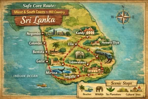
Safe Core Route: West & South Coasts to Hill Country
This core loop keeps you on the safest, most predictable roads: the
expressways and major A‑class highways along the west and south coasts,
then up into the central hills on well‑used routes. It is designed for
Sri Lankan drivers using petrol or diesel cars, but is also suitable for
hybrids.
Overview of the Core Loop
- Colombo / suburbs → Galle → Matara / Hambantota (South Coast)
- South Coast → Ella / Bandarawela (Lower Hill Country)
- Ella / Bandarawela → Nuwara Eliya / Hatton (Central Hills)
- Nuwara Eliya / Hatton → Kandy → Colombo
You can join or exit this loop from any major city on the western or
southern seaboard (Negombo, Kalutara, Galle, Matara) or from Kandy.
Distances and fuel costs below are approximate and should be adjusted for
your vehicle’s real‑world fuel consumption and current pump prices.
1. Colombo to Galle & South Coast (E01 + A2)
Recommended Route
- Colombo → Galle via E01 Southern Expressway
- Galle → Matara → Hambantota via E01 (to Matara), then A2 coastal road or E01 extension where available
Why this route is safe
- E01 has controlled entry/exit, better surface, lighting in key sections, wide lanes and clear signage.
- Less mixed traffic (fewer three‑wheelers, cycles, pedestrians) than A‑ and B‑class roads.
- Lower risk of stray animals and sudden obstacles compared to interior B‑roads.
- Fast access to major towns with hospitals, police and service stations (Kalutara, Bentota, Galle, Matara).
Distance, time & tolls
- Colombo – Galle: about 120 km, typically 1.5–2 hours via E01.
- Galle – Matara: about 45 km, 40–60 minutes via E01 or A2.
- Matara – Hambantota: about 100–110 km, 2–2.5 hours on A2 (longer if many stops).
- Expect multiple toll booths on the E01. Keep cash (small notes) ready; tolls are higher for large SUVs and vans.
Indicative fuel use & cost (segment)
For a typical 1.3–1.5L petrol car doing around 12–14 km/L in mixed
conditions:
- Colombo → Galle (120 km): roughly 9–10 L of fuel.
- Galle → Matara → Hambantota (~150 km total): roughly 11–13 L.
- Multiply litres by today’s per‑litre pump price for your fuel type to estimate cost.
Safety tips for this leg
- Use E01 over Galle Road (A2) if you prioritise safety and predictability over scenery.
- On the A2, expect buses overtaking aggressively, frequent junctions and pedestrians crossing without signals.
- Avoid entering or exiting Colombo during school/office peak (approximately 7–9 a.m. and 4–7 p.m.) to reduce stress and risk.
- Check weather during monsoon seasons; coastal stretches can be slippery in heavy rain.
2. South Coast to Ella / Bandarawela
Recommended Routes
- Hambantota / Tangalle → Wellawaya → Ella via A2 → A18 → A23
- Matara → Akuressa → Deniyaya → Rakwana → Balangoda → Bandarawela via A17 → A18 → A4 (more mountainous and scenic; drive only in good daylight and weather)
Safer option
For most Sri Lankan families and less experienced hill drivers, the
Hambantota / Tangalle – Wellawaya – Ella route is safer:
- Roads are wider on many sections and gradients are more manageable than deep‑hill alternatives.
- Traffic is lighter than around Kandy or Colombo.
- Fewer blind, continuous hairpins than on older hill routes.
Distance, time & indicative fuel
- Hambantota – Wellawaya – Ella: about 165–185 km, typically 3.5–4.5 hours.
- Matara – Deniyaya – Balangoda – Bandarawela: about 200–230 km but can easily take 6–8 hours with breaks.
- Fuel for 180–220 km in a small petrol car: approximately 14–18 L depending on gradients and driving style.
Hill‑country safety tips (this leg)
- Plan your departure from the coast so that you finish the ascent well before dark.
- Use lower gears on descents; avoid continuous braking to reduce brake fade.
- Expect slow vehicles (lorries, buses) and be patient. Only overtake when you have a long, clear view and no blind corners.
- Watch for falling rocks and debris after heavy rain, especially near Deniyaya and on A4 segments.
- Keep headlights on low beam in mist; use fog lights if available, never high beam into fog.
3. Ella / Bandarawela to Nuwara Eliya / Hatton
Recommended Route
- Ella / Bandarawela → Haputale → Diyatalawa → Nuwara Eliya via A16 / B‑class hill roads, or
- Bandarawela → Haputale → Beragala → Balangoda → Hatton via A16 → A4 → B149
Safety considerations
- These are classic hill‑country roads: narrow, winding, with frequent hairpins and steep drop‑offs.
- Surfaces are generally reasonable but can have sudden potholes, broken edges and loose gravel.
- Traffic is moderate but mixed: buses, lorries, tuk‑tuks, slow vans and occasional livestock.
Distance, time & indicative fuel
- Ella – Nuwara Eliya: about 120–140 km, usually 3.5–5 hours depending on stops.
- Bandarawela – Hatton via Balangoda: roughly 130–150 km, often 4–5.5 hours.
- Fuel for 130–150 km in the hills: approximately 11–13 L in a small petrol car.
Extra safety in high hills
- Avoid driving in heavy mist or during intense evening rain; visibility can suddenly drop to a few metres.
- Use lay‑bys and wider patches to let faster vehicles pass instead of racing buses on bends.
- Do not park at blind corners for photo stops; look for designated viewpoints or wide shoulders.
- Carry warm clothing and water; breakdowns at higher altitude can be uncomfortable at night.
4. Nuwara Eliya / Hatton to Kandy and Back to Colombo
Recommended Routes
- Nuwara Eliya → Kandy via A5 (Nuwara Eliya – Nawalapitiya – Gampola – Kandy)
- Hatton → Kandy via B149 / A7 / A5 (Hatton – Gampola – Kandy)
- Kandy → Colombo via:
- A1 (Kandy Road) – shorter distance, more traffic and overtaking risk, or
- A10 → E02 / E03 combination via Katugastota – Kurunegala expressway access, where available, for more relaxed driving.
Safety profile
- The A5 and A7 are key trunk roads; surfaces are generally better and signage clearer than minor B‑roads.
- Kandy – Colombo A1 has heavy traffic, buses and frequent junctions; drive defensively and avoid peak hours.
- Using expressway connections from the Kurunegala side to reach the Colombo network reduces time spent in dense suburban traffic.
Distance, time & indicative fuel
- Nuwara Eliya – Kandy: about 80–90 km, 2.5–3.5 hours.
- Hatton – Kandy: about 75–90 km, 2.5–3 hours.
- Kandy – Colombo via A1: about 115–130 km, usually 3–4 hours depending on traffic.
- Kandy – Colombo via Kurunegala / expressway mix: slightly longer distance but similar or shorter time, with safer, more consistent speeds.
- Fuel for Kandy – Colombo: around 9–11 L in a small petrol car.
Tolls and timing
- Expect tolls on any expressway segments west of Kurunegala toward Colombo.
- Plan to pass Kegalle, Warakapola and Kiribathgoda outside school and office rush hours if using A1.
- For Kandy city itself, use the outer circular roads where possible; the old town centre clogs easily.
Fuel Planning for the Core Loop
Approximate total distances (full loop)
- Colombo – Galle – Hambantota – Ella – Nuwara Eliya – Kandy – Colombo: roughly 750–850 km depending on detours.
Estimating fuel for your car
Use this simple approach:
- Calculate your realistic km per litre (e.g., 12 km/L or 15 km/L) based on your typical use.
- Divide the total planned distance by your km/L to get total litres needed.
- Multiply by the current per‑litre pump price for your fuel type.
Example for a 12 km/L petrol car on an 800 km loop:
- 800 ÷ 12 ≈ 67 L total fuel.
- If petrol is, for example, 550 LKR/L, total fuel cost ≈ 67 × 550.
Where to refuel safely
- On E01 and around major towns (Kalutara, Galle, Matara, Hambantota, Wellawaya, Ella, Nuwara Eliya, Kandy, Kurunegala, outskirts of Colombo) you will find multiple filling stations.
- In the hills, refuel when your tank reaches half; do not wait for the low‑fuel light, as stations can be sparse on some B‑roads.
- Prefer larger, branded stations with card facilities and visible safety standards where possible.
General Safety Practices for this Core Route
- Drive by day: Plan long legs between roughly 6 a.m. and 6 p.m., especially in the hills and on rural stretches.
- Download offline maps and keep a hard‑copy map or key junction list as backup in case of signal loss.
- Vehicle check before leaving: brakes, coolant, tyres (including spare), jack and basic tools.
- Share your route and ETA with family or friends, particularly for the hill segments.
- Keep a first‑aid kit, torch, phone charger and some cash for tolls and small rural shops.
- Respect local speed limits; use your horn briefly before blind bends in the hills as locals do, but avoid aggressive driving.
Following this west–south–hills core loop lets you complete an island‑wide style road trip while staying on the most reliable, safest major routes, with clear options to add side trips to the East and North if time and
fuel budget allow.
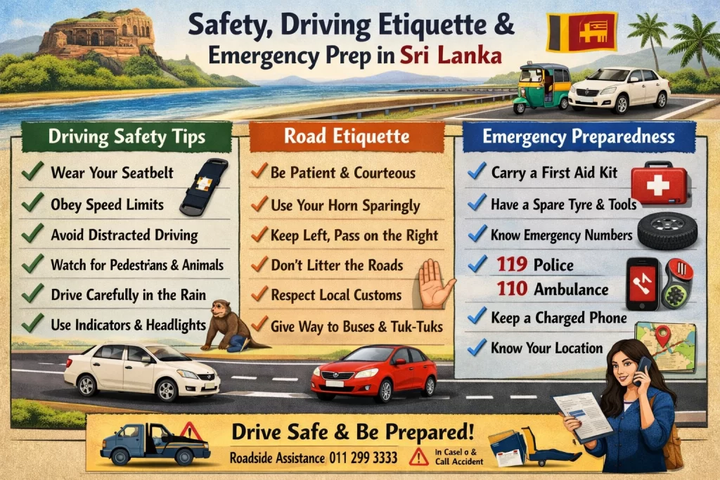
Safety, Driving Etiquette, and Emergency Prep
Core Road Safety Rules
Sri Lanka follows left-hand traffic with right-hand drive vehicles, similar to the UK and India. Always keep to the left lane and overtake on the right. Speed limits are generally around 50–60 km/h in towns and up to 100 km/h on expressways; in school or hospital zones limits can drop to about 40 km/h. Seatbelts are mandatory for front passengers, and using a mobile phone while driving is illegal unless hands-free. Strict laws apply against drunk driving, so avoid alcohol entirely when you are the driver.
For an island‑wide itinerary, plan your longest transfers in daylight. Avoid night driving, especially on rural, coastal, or hill country roads where lighting is poor, animals wander onto the road, and heavy vehicles and buses can drive aggressively.
Driving Etiquette and Local Norms
Local driving style can feel assertive and unpredictable, even for Sri Lankans who mainly drive in one region. Across the island you will share the road with buses, tuk‑tuks, motorbikes, bicycles, pedestrians, cattle, dogs, and occasionally wildlife. Defensive driving is essential.
- Use of horn: The horn is a communication tool, not an insult. A short honk often means “I’m overtaking” or “I’m here, be aware.” Do not react emotionally; respond by checking mirrors and giving space if safe.
- Overtaking culture: Expect frequent overtakes, sometimes on short gaps. Always indicate clearly, check mirrors and blind spots, and never overtake on blind corners, hill crests, or in wet conditions. Assume oncoming traffic may also be overtaking.
- Bus etiquette: Intercity and private buses are among the most aggressive road users. Give them extra space, expect sudden lane changes or stops near junctions and bus halts, and avoid driving parallel to a bus for long stretches.
- Tuk‑tuks and bikes: Tuk‑tuks and motorcycles often weave between lanes and use road shoulders. Keep a safe lateral gap and anticipate that they may cut in front of you when traffic slows.
- Roundabouts and junctions: Enter slowly, yield to vehicles coming from your right, and avoid blocking the junction. Signal early when exiting roundabouts.
- Pedestrians and local life: In towns and villages, people may step onto the road to cross or board buses without much warning. Slow down around markets, schools, and temples, particularly on Poya days and festival periods.
Route‑Specific Safety Considerations
On an island‑wide trip you will likely combine expressways, A‑class highways, coastal roads, and hill‑country routes.
- Expressways (E-roads): These are the safest and fastest for long distances, with controlled access and better surfaces. Only cars and light vehicles are allowed; heavy vehicles and tuk‑tuks are restricted. Maintain lane discipline, keep to the left except when overtaking, and watch for sudden slow traffic near exits and toll plazas.
- Hill country roads: Around areas like Kandy, Nuwara Eliya, Ella, Haputale, and Badulla, expect narrow, winding roads, steep climbs, sharp hairpins, and mist or rain. Use low gears on climbs and descents, avoid cutting corners, and use headlights in fog or heavy rain. In monsoon seasons, watch for fallen branches, rocks, or minor landslides.
- National parks and rural edges: Near places like Yala, Udawalawe, Wilpattu, or Wasgamuwa, slow down for wildlife crossings, especially at dawn, dusk, and night. Never honk or race near elephants; if an elephant is near or on the road, keep a safe distance, wait for it to cross, and follow any local guidance.
- Coastal and village roads: Narrow shoulders, parked vehicles, and informal roadside stalls are common. Drive slower than the posted limit if visibility is blocked by buses, trucks, or bends.
Car Preparation and In‑Car Safety
- Documents to carry: Keep your driving licence, national or provincial driving permit, vehicle registration, insurance, emission certificate (if applicable), and NIC or passport in the car, but not all in a visible place. You may face random police checkpoints, especially near major junctions and provincial borders.
- Basic safety checks: Before each long leg, check tyre pressure (including spare), engine oil, coolant, windshield washer fluid, and lights (headlights, brake lights, indicators, hazard lights). On multi‑day island trips, recheck at least every 2–3 days.
- Seatbelts and child seats: Insist that everyone in front wears seatbelts, and ideally rear passengers as well. For children, use proper child seats or boosters rather than holding them on laps.
- Load management: Secure luggage so it cannot fly forward in hard braking. Avoid stacking heavy bags on parcel shelves where they block rear visibility.
Weather, Time of Day, and Fatigue
- Daylight advantage: Plan to complete most driving between sunrise and early evening. This is critical in unfamiliar districts with limited street lighting.
- Rain and monsoon: In heavy rain, slow down, switch on headlights (not hazards while moving), increase following distance, and avoid sudden braking. Standing water can hide potholes and cause hydroplaning.
- Heat and long drives: Keep the cabin cool, stay hydrated, and schedule a short break every 2–3 hours. Fatigue and dehydration are major contributors to highway accidents.
Police, Checkpoints, and Tolls
Roadblocks and checkpoints are common around major cities, provincial boundaries, and high‑security or sensitive areas. When stopped, remain calm, polite, and in the vehicle unless asked to step out. Present documents on request and comply with instructions. Do not offer cash unofficially; if a fine is issued, ask for the official receipt and follow the indicated process.
At toll booths on expressways, reduce speed early, keep to the correct lane for your payment method (cash or electronic pass if you have one), have money ready, and avoid sudden lane changes. After the booth, merge smoothly and accelerate only once fully clear of pedestrians and other vehicles.
Emergency Preparedness
A well‑prepared car and plan dramatically reduce stress if something goes wrong on a long, multi‑district route.
- Essential emergency kit: Carry a first‑aid kit, warning triangle, reflective vest, torch with spare batteries, basic tool kit (screwdrivers, pliers, adjustable spanner), tyre inflator or foot pump, and jumper cables. Include a charged power bank for phones.
- Tyre and breakdown readiness: Ensure you have a usable spare wheel, jack, and wheel spanner, and that you know how to use them. On punctures, move the car to the safest possible shoulder before changing tyres. If it feels unsafe (blind bend, heavy traffic), stay in the vehicle with seatbelts on, hazards on, and call roadside assistance.
- Key contacts: Save roadside assistance numbers for your insurer or leasing company, the vehicle owner (if borrowed or rented), your regular mechanic, and local emergency services such as 119 (police), 1990 (ambulance service), and the toll‑road emergency hotline printed on expressway signboards.
- Accidents and incidents: In any collision, prioritise safety: move to a safe area if vehicles are drivable, switch on hazard lights, and use the warning triangle. Avoid arguments on the road; call the police to document the incident and inform your insurance provider before moving vehicles when possible.
Health, Security, and Personal Safety on the Road
- Valuables and parking: Do not leave valuables visible inside the car when parked. Use well‑lit, busy parking areas—hotel or restaurant car parks, official lots near tourist sites, or locations with an attendant.
- Food, water, and rest: Keep drinking water and light snacks in the car. For very long legs (e.g., North–South or East–West crossings), plan meal stops at known towns rather than isolated roadside stalls late at night.
- Navigation safety: Assign a passenger as navigator where possible. If driving alone, set the route before moving and rely on voice guidance rather than staring at the screen. Pull over to a safe spot if you need to recheck maps.
Island‑Wide Itinerary Planning with Safety in Mind
When designing your Sri Lanka–wide route, balance distance, daylight, and road type. As a rule of thumb, even on good roads average speeds rarely exceed 50–60 km/h across a full day once traffic, town passages, and stops are factored in. For each leg:
- Limit driving to 4–6 hours of actual wheel time per day, breaking it into segments with rest stops.
- Prefer expressways for the longest links between provinces, exiting to A‑ and B‑class roads only for the final approach to smaller towns and attractions.
- Avoid scheduling back‑to‑back late‑arrival and early‑departure days; fatigue accumulates over a multi‑day loop around the island.